
Ocean Rift Zone Spreads Rapidly in Sudden Underwater Event
Scientists witnessed a mid-ocean rift zone between the Australian and Antarctic plates spread over a short period in April 2024. The event involved rapid seafloor changes and magma activity, revealing new insights into tectonic plate movement.

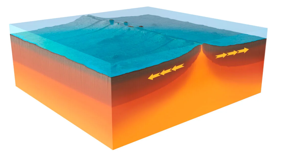
Scientists have captured unprecedented data on a significant geological event at a mid-ocean rift zone, revealing that the seafloor spread at an astonishingly rapid pace. The study, conducted on the boundary between the Australian and Antarctic plates, utilized a newly installed monitoring system that captured a burst of tectonic activity in April 2024. This event offers a rare glimpse into the dynamic processes that shape our planet's crust.
The remote location, situated in the Indian Ocean roughly halfway between Australia and Madagascar, is part of the Amsterdam–Saint Paul Plateau. This undersea feature rises significantly above the ocean floor and is thought to be influenced by a deep ocean hotspot. The rift zone itself runs directly through the plateau, a critical area for understanding plate tectonics. Despite the geological activity, the region is sparsely populated by islands, with only Amsterdam and St. Paul islands breaking the surface.
The French government maintains research stations on these islands, facilitating periodic scientific expeditions. A team of French researchers took advantage of one such mission to deploy a sophisticated array of underwater monitoring stations. These instruments included hydrophones to detect seismic activity and transmitters to measure precise distance changes between the stations, effectively tracking the spreading of the seafloor. Subsequent visits by French research vessels conducted three-dimensional mapping to document the physical outcomes of the observed events.
Rapid Seafloor Deformation and Magma Flow
Prior research indicated that the spreading rate in this specific area averages just over 60 millimeters per year. This activity typically occurs within a prominent depression, about 2,000 meters deep, bordered by rugged ridges. However, the April 2024 event far exceeded these gradual changes. The monitoring system recorded a series of seismic events that progressively shifted south along the spreading zone, covering over 8 kilometers. This was followed by a northward progression of activity, extending an additional 9 kilometers.
Researchers interpret these seismic shifts as indicative of dyke formation—the intrusion of molten rock into thin, elongated fractures within the Earth's crust. Simultaneously, sensors positioned in the central valley of the spreading region detected a significant drop, indicating subsidence. This sinking accelerated to about 5 centimeters per minute as the dyke events continued, with a total subsidence of 4.2 meters over a six-day period. This phenomenon is attributed to the draining of a magma reservoir beneath the ridge.
Consistent with the magma reservoir's activity, water temperatures near the instruments began to rise, suggesting interaction between the molten rock and seawater. Adding to the complexity, instruments on opposite sides of the central valley began to drift apart, with some separating by more than a meter. This rapid deformation provides crucial data for understanding how new oceanic crust is formed.
Following the period of heightened activity, a French research vessel returned to the site for further mapping. Even with the limitations of the imaging technology, researchers observed significant uplift in some areas, with some patches of new seafloor material rising over 90 meters higher than in previous surveys. One newly formed section measured approximately 4 kilometers in length, with an estimated 150 million cubic meters of new material deposited. This suggests that much of the spreading occurred in a concentrated period.
Modeling the event by randomizing millions of configurations of magma sources, dyke extents, and fault geometries, the research team identified key commonalities in scenarios that matched the observed data. These models pointed to the collapse of a deep reservoir of molten material known as a sill, which is essentially a horizontal intrusion. Some of this magma was channeled into an associated dyke, causing it to expand, while faults in the area also widened by 2 to 4 meters. The total extension recorded is equivalent to 38 years of average spreading at this site.
The findings suggest that mid-ocean spreading may not always be a gradual process. Instead, it could involve a buildup of strain and magma followed by a series of rapid, transformative events that quickly generate new seafloor. Furthermore, the observation that some critical events occurred without significant seismic signals challenges existing assumptions. It indicates that relying solely on seismic data may lead to an incomplete picture of the dynamic processes involved in the renewal of the Earth's crust.